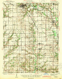
1943 Map of Newton
USGS Topo · Published 1943About this map
The Embarrass River meanders across this landscape, defining the character of the borderlands between Jasper and Richland counties during the early 1940s. The regional economy is anchored by the Illinois Central railroad, which connects the hub of Newton to smaller outlying settlements like Ste Marie, West Liberty, and Willow Hill. This era reveals an incredibly dense network of rural infrastructure, where nearly every township section is served by its own local schoolhouse, such as Brush College Sch, Onion Prairie Sch, and Happy Hollow Sch.
Find a feature on this map
79 named features on this map. Tap any name to fly to it.
Don’t see what you’re looking for? This feature index may not catch every label — zoom into the map to look around manually.
Map Details
Editions of this 1943 Newton Map
2 editions found
Other maps of this area

1910 · Hardinville
USGS Topo · 1:62,500

1911 · Sumner
USGS Topo · 1:62,500

1913 · Sumner
USGS Topo · 1:62,500

1940 · Greenup
USGS Topo · 1:62,500

1941 · Newton
USGS Topo · 1:62,500

1943 · Greenup
USGS Topo · 1:62,500

1943 · Newton
USGS Topo · 1:62,500

1948 · Flora
USGS Topo · 1:62,500

1949 · Olney
USGS Topo · 1:62,500

1949 · Flora
USGS Topo · 1:62,500