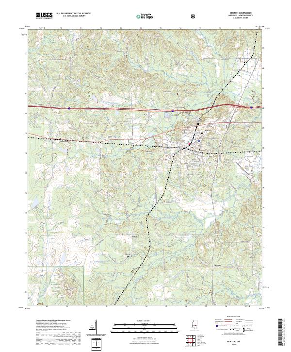
2024 Map of Newton
USGS Topo · Published 2024About this map
The town of Newton serves as the primary hub of this East Mississippi landscape, where the Kansas City Southern rail line bisects the community. Local history is deeply rooted in the area's burial grounds, including the Doolittle Confederate Cem and the Masonic Cem within the town limits, while the more remote Evans Cem is found near the settlement of Bethel. The southern portion of the quadrangle transitions into the protected timberlands of the Bienville National Forest, marked by landmarks such as Nance Hill.
Find a feature on this map
110 named features on this map. Tap any name to fly to it.
Don’t see what you’re looking for? This feature index may not catch every label — zoom into the map to look around manually.
Map Details
Editions of this 2024 Newton Map
This is the sole edition of this map. No revisions or reprints were ever made.
Other maps of this area

1921 · Forest
USGS Topo · 1:48,000

1922 · Forest
USGS Topo · 1:62,500

1950 · Forest
USGS Topo · 1:62,500

1952 · Forest
USGS Topo · 1:62,500

1953 · Meridian
USGS Topo · 1:250,000

1957 · Meridian
USGS Topo · 1:250,000

1965 · Meridian
USGS Topo · 1:250,000

1966 · Hickory
USGS Topo · 1:24,000

1966 · Newton
USGS Topo · 1:24,000

1966 · Decatur NW
USGS Topo · 1:24,000