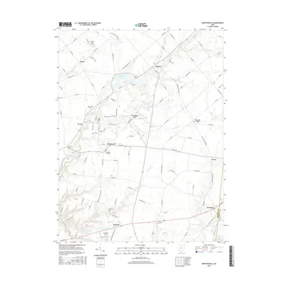
2016 Map of Newtonsville
USGS Topo · Published 2016About this map
Newtonsville and Monterey anchor this section of Clermont County, where the landscape is defined by the branching tributaries of the East Fork Little Miami River. The area maintains a rural character dominated by small settlements and numerous cemeteries that speak to the region's long settlement history, including the Old Baptist Church Cem and Brick Chapel Cem. Significant water features like Stonelick Lake and the Terra Aqua Lakes are prominent, alongside the recreation-focused Woodland Park. Small-scale aviation is a distinct local characteristic, evidenced by the presence of both Antique Acres Airpark and Clearwater Airpark. The road network connects older hubs like Edenton and Marathon with newer residential clusters, while names like Moores Fork and Lerado represent the persistent crossroads communities that have long served this part of Ohio.
Find a feature on this map
118 named features on this map. Tap any name to fly to it.
Don’t see what you’re looking for? This feature index may not catch every label — zoom into the map to look around manually.
Map Details
Editions of this 2016 Newtonsville Map
This is the sole edition of this map. No revisions or reprints were ever made.
Other maps of this area

1907 · Blanchester
USGS Topo · 1:62,500

1914 · Batavia
USGS Topo · 1:48,000

1914 · Morrow
USGS Topo · 1:62,500

1916 · Batavia
USGS Topo · 1:62,500

1916 · Morrow
USGS Topo · 1:62,500

1917 · Sardinia
USGS Topo · 1:62,500

1944 · Sardinia
USGS Topo · 1:62,500

1947 · Columbus
USGS Topo · 1:250,000

1953 · Goshen
USGS Topo · 1:24,000
1953 · Batavia
USGS Topo · 1:24,000