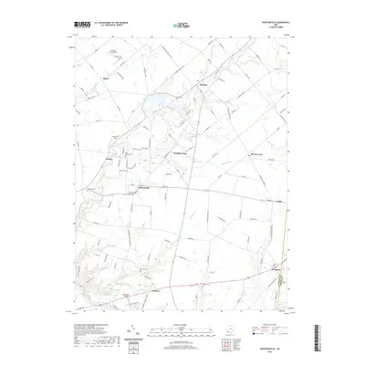
2019 Map of Newtonsville
USGS Topo · Published 2019About this map
Stonelick Cr and its numerous tributaries, including Moores Fork and Brushy Fork, carve a complex drainage pattern across this portion of Clermont County. The village of Newtonsville serves as a central hub, surrounded by smaller rural settlements like Modest, Edenton, and Monterey. The landscape is a mix of agricultural plots and residential pockets, with local history preserved in several scattered burial grounds such as Edenton Cem and Brick Chapel Cem.
Find a feature on this map
116 named features on this map. Tap any name to fly to it.
Don’t see what you’re looking for? This feature index may not catch every label — zoom into the map to look around manually.
Map Details
Editions of this 2019 Newtonsville Map
This is the sole edition of this map. No revisions or reprints were ever made.
Other maps of this area

1907 · Blanchester
USGS Topo · 1:62,500

1914 · Batavia
USGS Topo · 1:48,000

1914 · Morrow
USGS Topo · 1:62,500

1916 · Batavia
USGS Topo · 1:62,500

1916 · Morrow
USGS Topo · 1:62,500

1917 · Sardinia
USGS Topo · 1:62,500

1944 · Sardinia
USGS Topo · 1:62,500

1947 · Columbus
USGS Topo · 1:250,000

1953 · Goshen
USGS Topo · 1:24,000
1953 · Batavia
USGS Topo · 1:24,000