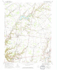
1968 Map of Newtonsville
USGS Topo · Published 1970About this map
Stonelick Lake State Park anchors this portion of Clermont County, centered on the dammed waters of Stonelick Lake and the surrounding woodlands. The landscape is a transition from the structured agricultural fields of Goshen and Jackson townships to the more dissected terrain along the East Fork Little Miami River. The settlement pattern in the late 1960s reveals a mix of rural villages like Newtonsville and Edenton, alongside educational landmarks such as the Clermont Northeastern High Sch. Local genealogy and community history are preserved in sites like Shiloh Ch and the Hartman Cem near the southern boundary. To the east, the rural character is defined by the winding course of Moores Fork and Brushy Fork, where small clusters of homes at Lerado and Marathon mark the intersection of country roads and drainage patterns.
Find a feature on this map
76 named features on this map. Tap any name to fly to it.
Don’t see what you’re looking for? This feature index may not catch every label — zoom into the map to look around manually.
Map Details
Editions of this 1968 Newtonsville Map
This is the sole edition of this map. No revisions or reprints were ever made.
Other maps of this area

1907 · Blanchester
USGS Topo · 1:62,500

1914 · Batavia
USGS Topo · 1:48,000

1914 · Morrow
USGS Topo · 1:62,500

1916 · Batavia
USGS Topo · 1:62,500

1916 · Morrow
USGS Topo · 1:62,500

1917 · Sardinia
USGS Topo · 1:62,500

1944 · Sardinia
USGS Topo · 1:62,500

1947 · Columbus
USGS Topo · 1:250,000

1953 · Goshen
USGS Topo · 1:24,000
1953 · Batavia
USGS Topo · 1:24,000