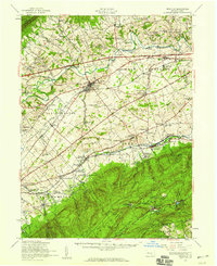
1952 Map of Newville
USGS Topo · Published 1959About this map
The Cumberland Valley unfolds between the steep ridges of Blue Mountain and South Mountain in this early 1950s survey. The landscape is defined by the winding course of Conodoguinet Creek and the emergence of the Pennsylvania Turnpike, which slices through traditional farmsteads and rural townships like Lower Mifflin and West Pennsboro. The settlement at Newville serves as a central hub, while the southern reaches of the map highlight industrial and recreational history at Pine Grove Furnace and Fuller Lake.
Find a feature on this map
120 named features on this map. Tap any name to fly to it.
Don’t see what you’re looking for? This feature index may not catch every label — zoom into the map to look around manually.
Map Details
Editions of this 1952 Newville Map
3 editions found
Other maps of this area

1902 · Chambersburg
USGS Topo · 1:62,500

1904 · Carlisle
USGS Topo · 1:62,500

1907 · New Bloomfield
USGS Topo · 1:62,500

1908 · Gettysburg
USGS Topo · 1:62,500

1909 · Fairfield
USGS Topo · 1:62,500

1919 · Newville
USGS Topo · 1:62,500

1919 · Mattawana
USGS Topo · 1:62,500

1923 · Shippensburg
USGS Topo · 1:62,500

1930 · Loysville
USGS Topo · 1:62,500

1933 · Loysville
USGS Topo · 1:62,500
Featured Places
- Shippensburg, PA
- Dickinson, Penn Township
- Plainfield, West Pennsboro Township
- Southampton Township, PA
- North Newton Township, PA