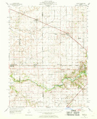
1954 Map of Niantic
USGS Topo · Published 1969About this map
Lincoln Homestead Memorial Park anchors the central landscape of this mid-century survey, situated along the Sangamon River where the legacy of early Illinois statehood is preserved. The terrain is a network of small agricultural hubs like Latham, Niantic, and Warrensburg, each tied together by a dense grid of steel including the Illinois Central and the Wabash Illinois Terminal. These rail lines define the growth patterns of the county, connecting grain elevators and local depots across the prairie.
Find a feature on this map
75 named features on this map. Tap any name to fly to it.
Don’t see what you’re looking for? This feature index may not catch every label — zoom into the map to look around manually.
Map Details
Editions of this 1954 Niantic Map
3 editions found
Other maps of this area

1911 · Lincoln
USGS Topo · 1:62,500

1913 · Lincoln
USGS Topo · 1:62,500

1923 · Taylorville
USGS Topo · 1:62,500

1925 · Taylorville
USGS Topo · 1:62,500

1929 · Decatur
USGS Topo · 1:62,500

1933 · Decatur
USGS Topo · 1:62,500

1949 · Dalton City
USGS Topo · 1:62,500

1952 · Assumption
USGS Topo · 1:62,500

1954 · Niantic
USGS Topo · 1:62,500

1954 · Mechanicsburg
USGS Topo · 1:62,500