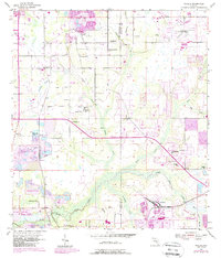
1955 Map of Nichols
USGS Topo · Published 1988About this map
Industrial phosphate extraction and rural community life define the landscape along the Hillsborough Co Polk Co line in the mid-1950s. The southern portion of the map is dominated by the Strip Mine operations and extensive Reclaimed Strip Mine areas surrounding the settlement of Nichols. These mining activities sit adjacent to the winding waters of the North Prong Alafia River and its many tributaries, including Thirtymile Creek and Sloman Br.
Find a feature on this map
44 named features on this map. Tap any name to fly to it.
Don’t see what you’re looking for? This feature index may not catch every label — zoom into the map to look around manually.
Map Details
Editions of this 1955 Nichols Map
4 editions found
Other maps of this area

1944 · Plant City
USGS Topo · 1:31,680

1944 · Lakeland
USGS Topo · 1:31,680

1944 · Antioch
USGS Topo · 1:31,680

1949 · Mulberry
USGS Topo · 1:24,000

1949 · Bradley Junction
USGS Topo · 1:24,000

1950 · Mulberry
USGS Topo · 1:24,000

1950 · Bradley Junction
USGS Topo · 1:24,000

1955 · Lithia
USGS Topo · 1:24,000

1955 · Nichols
USGS Topo · 1:24,000

1955 · Dover
USGS Topo · 1:24,000