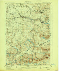
1921 Map of Nicholville
USGS Topo · Published 1929About this map
St Regis River and the Deer River define the industrial and residential settlement patterns of this northern Adirondack foothills region. Early 20th-century life centered on these waterways, where towns like St Regis Falls and Nicholville prospered alongside smaller clusters such as Dickinson Center and Fort Jackson. The map reveals a high density of rural education infrastructure, showing over a dozen numbered schoolhouses including Water Street School and Merchant Street School, suggesting a once-vibrant network of small communities. To the south, the terrain shifts into more mountainous country, dominated by peaks like Blue Mtn and Eagle Mtn. This area is characterized by numerous remote camps and clubs, such as Center Camp and the Cooperage Club, reflecting the era's transition from timber extraction to seasonal recreation around Lake Ozonia and the West Branch St Regis River.
Find a feature on this map
84 named features on this map. Tap any name to fly to it.
Don’t see what you’re looking for? This feature index may not catch every label — zoom into the map to look around manually.
Map Details
Editions of this 1921 Nicholville Map
4 editions found

Other maps of this area

1905 · Saint Regis
USGS Topo · 1:62,500

1906 · Massena
USGS Topo · 1:62,500

1907 · Massena
USGS Topo · 1:62,500

1908 · Potsdam
USGS Topo · 1:62,500

1915 · Malone
USGS Topo · 1:62,500

1915 · Moira
USGS Topo · 1:62,500

1917 · Malone
USGS Topo · 1:62,500

1917 · Moira
USGS Topo · 1:62,500

1919 · Nicholville
USGS Topo · 1:62,500

1920 · Childwold
USGS Topo · 1:62,500