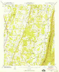
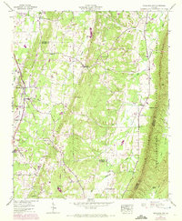
1946 Map of Nickajack Gap
USGS Topo · Published 1960About this map
Peavine Ridge and Taylor Ridge define the North Georgia terrain in this 1946 field study, creating a series of parallel valleys where rural communities established themselves along watercourses like Peavine Creek and Little Chickamauga Creek. The settlement at Wood Station and the smaller locality of Beaumont serve as local anchors, while the Chattahoochee National Forest covers the eastern elevations near Nickajack Gap.
Find a feature on this map
35 named features on this map. Tap any name to fly to it.
Don’t see what you’re looking for? This feature index may not catch every label — zoom into the map to look around manually.
Map Details
Editions of this 1946 Nickajack Gap Map
5 editions found
Other maps of this area

1886 · Ringgold
USGS Topo · 1:125,000

1892 · Ringgold
USGS Topo · 1:125,000

1935 · Catlett
USGS Topo · 1:24,000

1935 · East Ridge
USGS Topo · 1:24,000

1935 · Villanow
USGS Topo · 1:24,000

1935 · Ringgold
USGS Topo · 1:24,000

1935 · Nickajack Gap
USGS Topo · 1:24,000

1935 · Tunnel Hill
USGS Topo · 1:24,000

1936 · Kensington
USGS Topo · 1:24,000

1936 · Estelle
USGS Topo · 1:24,000