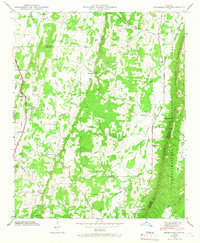
1946 Map of Nickajack Gap
USGS Topo · Published 1966About this map
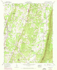
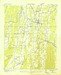
Peavine Valley and its surrounding ridges dominate this 1946 survey, showing a landscape defined by traditional Georgia farming communities and early transportation routes. The Central of Georgia Railway runs parallel to Georgia Highway 27 through the settlement of Rock Spring, providing a clear view of the rail-and-road corridor that linked these valley towns. Further east, the terrain rises sharply toward Taylor Ridge, where the Chattahoochee National Forest begins. This map preserves the locations of numerous rural institutions that anchored local life, including Mt Pisgah Sch and Peavine Ch. Of particular interest to researchers is the intersection of three counties — Catoosa, Walker, and Whitfield — which meet near the natural pass of Nickajack Gap. The presence of established homesteads and family burial sites like Yates Cem and Mc Intyre Cem offers a detailed record of the families settled along Peavine Creek and Little Chickamauga Creek in the immediate post-war era.
Find a feature on this map
59 named features on this map. Tap any name to fly to it.
Don’t see what you’re looking for? This feature index may not catch every label — zoom into the map to look around manually.
Map Details
Editions of this 1946 Nickajack Gap Map
5 editions found
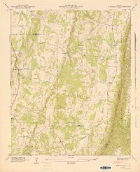
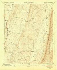
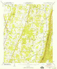
Other maps of this area

1886 · Ringgold
USGS Topo · 1:125,000

1892 · Ringgold
USGS Topo · 1:125,000

1935 · Catlett
USGS Topo · 1:24,000

1935 · East Ridge
USGS Topo · 1:24,000
1935 · Villanow
USGS Topo · 1:24,000
1935 · Ringgold
USGS Topo · 1:24,000
1935 · Nickajack Gap
USGS Topo · 1:24,000
1935 · Tunnel Hill
USGS Topo · 1:24,000

1936 · Kensington
USGS Topo · 1:24,000

1936 · Estelle
USGS Topo · 1:24,000