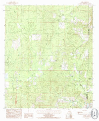
1984 Map of Nickel
USGS Topo · Published 1985About this map
Nickel and Aimwell anchor this rural landscape in central Louisiana, situated along the border of La Salle Parish and Catahoula Parish. The map reveals a terrain defined by subtle elevation changes and numerous watercourses, including the curiously named Bayou Funny Louis and the meandering Brushy Creek. One of the most significant historical markers shown is an Old Railroad Grade, which suggests the legacy of early 20th-century timber operations that once dominated this region.
Find a feature on this map
17 named features on this map. Tap any name to fly to it.
Don’t see what you’re looking for? This feature index may not catch every label — zoom into the map to look around manually.
Map Details
Editions of this 1984 Nickel Map
This is the sole edition of this map. No revisions or reprints were ever made.
Other maps of this area

1941 · Manifest
USGS Topo · 1:62,500

1941 · Jena
USGS Topo · 1:62,500

1941 · Harrisonburg
USGS Topo · 1:62,500

1953 · Alexandria
USGS Topo · 1:250,000

1953 · Natchez
USGS Topo · 1:250,000

1955 · Alexandria
USGS Topo · 1:250,000

1955 · Olla
USGS Topo · 1:62,500

1956 · Natchez
USGS Topo · 1:250,000

1958 · Jena
USGS Topo · 1:62,500

1959 · Natchez
USGS Topo · 1:250,000