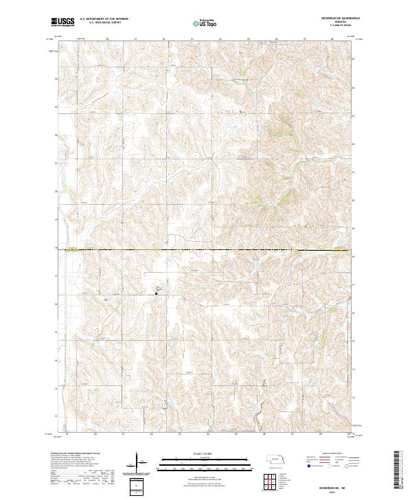
2021 Map of Nickerson NE
USGS Topo · Published 2021About this map
New England Cem stands as a quiet landmark within the rolling agricultural landscape of eastern Nebraska, marking the division between Burt and Washington counties. This modern topographic survey illustrates a drainage system defined by numerous family-named or locality-named waterways, such as Bell Cr, New York Cr, and Hill Cr, which carve through the loess hills. The map highlights the intersection of late-century land management and traditional farming patterns, featuring water control sites like Cameron Reservoir and Skinner Reservoir. The rural infrastructure is anchored by an extensive grid of county roads, such as Co RD 27 and Co RD p2, which continue to follow the ancestral township lines of Township 20 North, Range 10 East and its neighbors.
Find a feature on this map
43 named features on this map. Tap any name to fly to it.
Don’t see what you’re looking for? This feature index may not catch every label — zoom into the map to look around manually.
Map Details
Editions of this 2021 Nickerson NE Map
This is the sole edition of this map. No revisions or reprints were ever made.
Other maps of this area

1955 · Fremont
USGS Topo · 1:250,000

1957 · Fremont
USGS Topo · 1:250,000

1958 · Fremont
USGS Topo · 1:250,000

1966 · Oakland
USGS Topo · 1:24,000

1966 · Nickerson
USGS Topo · 1:24,000

1966 · Nickerson NW
USGS Topo · 1:24,000
1969 · Orum
USGS Topo · 1:24,000

1970 · Oakland SE
USGS Topo · 1:24,000

1970 · Herman
USGS Topo · 1:24,000
1970 · Nickerson NE
USGS Topo · 1:24,000