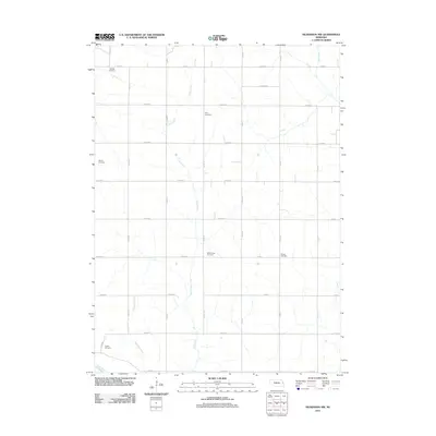
2011 Map of Nickerson NW
USGS Topo · Published 2011About this map
Uehling Cemetery and Argo Cemetery anchor this rural landscape in Dodge County, Nebraska, where the section-line road grid organizes a landscape defined by its waterways. The map illustrates a meticulously planned agricultural district where primary drainage is provided by Clark Creek, Bachelor Creek, and the Bell Creek in the northeast corner. A significant modification to the natural hydrology is visible in the southwest, where the Logan Creek Dredge cuts across the terrain, indicating historical engineering to manage the low-lying plains. The distribution of family and community burial grounds, including the Baptist Cemetery, Admah Cemetery, and West Admah Cemetery, reflects the early settlement patterns and the enduring local history of the surrounding townships.
Find a feature on this map
38 named features on this map. Tap any name to fly to it.
Don’t see what you’re looking for? This feature index may not catch every label — zoom into the map to look around manually.
Map Details
Editions of this 2011 Nickerson NW Map
This is the sole edition of this map. No revisions or reprints were ever made.
Other maps of this area

1955 · Fremont
USGS Topo · 1:250,000

1957 · Fremont
USGS Topo · 1:250,000

1958 · Fremont
USGS Topo · 1:250,000

1966 · Oakland
USGS Topo · 1:24,000

1966 · West Point SE
USGS Topo · 1:24,000

1966 · Uehling
USGS Topo · 1:24,000

1966 · Nickerson
USGS Topo · 1:24,000

1966 · Hooper
USGS Topo · 1:24,000

1966 · Nickerson NW
USGS Topo · 1:24,000
1969 · Orum
USGS Topo · 1:24,000