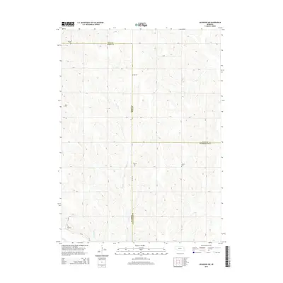
2014 Map of Nickerson NW
USGS Topo · Published 2014About this map
Agricultural lifeways across the undulating plains of eastern Nebraska are clearly defined on this map where Dodge, Burt, and Washington Counties converge. The landscape is primarily organized by a strict grid of county roads such as Co Line Rd and H Blvd, which navigate the drainage basins of Clark Cr and Bell Cr. For genealogists, the map is particularly rich in cemetery locations that anchor the history of these farming townships. Small burial sites including Argo Cem, Baptist Cem, and the dual locations of Admah Cem and W Admah Cem serve as vital markers for family history research. In the southern portion of the quadrangle, Bachelor Cr winds through the hills near Logan Cem, illustrating the way early rural communities established their sacred spaces and boundaries along the natural contours of the Platte River valley watershed.
Find a feature on this map
44 named features on this map. Tap any name to fly to it.
Don’t see what you’re looking for? This feature index may not catch every label — zoom into the map to look around manually.
Map Details
Editions of this 2014 Nickerson NW Map
This is the sole edition of this map. No revisions or reprints were ever made.
Other maps of this area

1955 · Fremont
USGS Topo · 1:250,000

1957 · Fremont
USGS Topo · 1:250,000

1958 · Fremont
USGS Topo · 1:250,000

1966 · Oakland
USGS Topo · 1:24,000

1966 · West Point SE
USGS Topo · 1:24,000

1966 · Uehling
USGS Topo · 1:24,000

1966 · Nickerson
USGS Topo · 1:24,000

1966 · Hooper
USGS Topo · 1:24,000

1966 · Nickerson NW
USGS Topo · 1:24,000
1969 · Orum
USGS Topo · 1:24,000