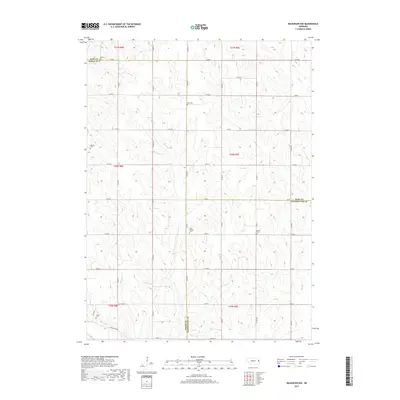
2017 Map of Nickerson NW
USGS Topo · Published 2017About this map
Agricultural lands at the convergence of Dodge, Burt, and Washington Counties characterize this rural Nebraska landscape. The terrain is defined by the drainage basins of several waterways, including Clark Cr and Bell Cr, which carve through the townships. For genealogists, the map is particularly valuable for its documentation of numerous small burial grounds that serve as the primary markers of historical community centers. These include Argo Cem, West Admah Cem, and the Admah Cem further east. In the southern portion of the quadrangle, Bachelor Cr winds near Logan Cem, while the far northwestern corner includes the Uehling Cem. The grid of county roads, such as Co RD 24 and Co RD 50, follows the section lines of the Public Land Survey System, illustrating the enduring township-and-range organization of this prairie region.
Find a feature on this map
45 named features on this map. Tap any name to fly to it.
Don’t see what you’re looking for? This feature index may not catch every label — zoom into the map to look around manually.
Map Details
Editions of this 2017 Nickerson NW Map
This is the sole edition of this map. No revisions or reprints were ever made.
Other maps of this area

1955 · Fremont
USGS Topo · 1:250,000

1957 · Fremont
USGS Topo · 1:250,000

1958 · Fremont
USGS Topo · 1:250,000

1966 · Oakland
USGS Topo · 1:24,000

1966 · West Point SE
USGS Topo · 1:24,000

1966 · Uehling
USGS Topo · 1:24,000

1966 · Nickerson
USGS Topo · 1:24,000

1966 · Hooper
USGS Topo · 1:24,000

1966 · Nickerson NW
USGS Topo · 1:24,000
1969 · Orum
USGS Topo · 1:24,000