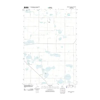
2010 Map of Niemackl Lakes
USGS Topo · Published 2010About this map
Glacial depressions and riparian corridors define this corner of Grant County, where the Mustinka River winds through the northern landscape past the Mustinka River Dam and into the Mustinka Flowage. The region is a dense network of water bodies, ranging from the prominent Niemackl Lakes to the expansive Hazzard Lakebed, illustrating the area’s complex drainage and high water table. Human presence is marked by a rigid grid of township roads such as TWP HWY 174 and TWP HWY 69, which navigate around the numerous sloughs and basins. For those researching local heritage, the map identifies several significant landmarks including the Lakeside Cemetery near Nelson Lake and the Saint Charles Cemetery further south. Recreational and community sites, such as the Niemackl Lake Park Campground, are situated alongside these natural features, showing how the local geography has shaped settlement and utility.
Find a feature on this map
50 named features on this map. Tap any name to fly to it.
Don’t see what you’re looking for? This feature index may not catch every label — zoom into the map to look around manually.
Map Details
Editions of this 2010 Niemackl Lakes Map
This is the sole edition of this map. No revisions or reprints were ever made.
Other maps of this area

1910 · Chokio
USGS Topo · 1:62,500

1911 · Barrett
USGS Topo · 1:62,500

1911 · Herman
USGS Topo · 1:62,500

1912 · Chokio
USGS Topo · 1:62,500

1912 · Morris
USGS Topo · 1:62,500

1953 · Milbank
USGS Topo · 1:250,000

1953 · Saint Cloud
USGS Topo · 1:250,000

1957 · Saint Cloud
USGS Topo · 1:250,000

1958 · Milbank
USGS Topo · 1:250,000

1958 · Saint Cloud
USGS Topo · 1:250,000