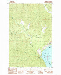
1985 Map of Ninemile Flat
USGS Topo · Published 1985About this map
The Colville Indian Reservation dominates this landscape along the western banks of the Columbia River in the mid-1980s. The terrain is defined by the steep descent from Gold Mountain Ridge toward the wide expanse of Franklin D Roosevelt Lake. Central to the geography is Ninemile Flat, a shelf of land situated above the water where Ninemile Creek and its many tributaries, including the South Fork and Little Ninemile Creek, carve through the complex topography.
Find a feature on this map
22 named features on this map. Tap any name to fly to it.
Don’t see what you’re looking for? This feature index may not catch every label — zoom into the map to look around manually.
Map Details
Editions of this 1985 Ninemile Flat Map
3 editions found
Other maps of this area

1948 · Wilbur
USGS Topo · 1:62,500

1948 · Wilmont Creek
USGS Topo · 1:62,500

1948 · Lincoln
USGS Topo · 1:62,500

1950 · Lincoln
USGS Topo · 1:62,500

1950 · Wilmont Creek
USGS Topo · 1:62,500

1950 · Wilbur
USGS Topo · 1:62,500

1952 · Keller
USGS Topo · 1:62,500

1953 · Ritzville
USGS Topo · 1:250,000

1954 · Okanogan
USGS Topo · 1:250,000

1956 · Wilmont Creek
USGS Topo · 1:62,500