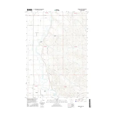
2017 Map of Ninemile Point
USGS Topo · Published 2017About this map
The Bighorn River flows northward through this section of Big Horn County, defining the agricultural and industrial character of the valley north of Hardin. The landscape is shaped by complex water management, including the Lone Tree-Coulee Big Horn Low Line Canal, which supports the lowlands west of the river. To the south, industrial activity is noted near the Hardin Generation Station Rd, while the eastern terrain rises toward distinctive high points like Hive Butte.
Find a feature on this map
45 named features on this map. Tap any name to fly to it.
Don’t see what you’re looking for? This feature index may not catch every label — zoom into the map to look around manually.
Map Details
Editions of this 2017 Ninemile Point Map
This is the sole edition of this map. No revisions or reprints were ever made.
Other maps of this area

1894 · Fort Custer
USGS Topo · 1:125,000

1954 · Hardin
USGS Topo · 1:250,000

1957 · Hardin
USGS Topo · 1:250,000

1958 · Hardin
USGS Topo · 1:250,000

1960 · Foster
USGS Topo · 1:24,000

1960 · Ninemile Point
USGS Topo · 1:24,000

1960 · Chimney Creek
USGS Topo · 1:24,000

1960 · Walker Hill
USGS Topo · 1:24,000

1960 · Hardin
USGS Topo · 1:24,000
1960 · Lemon Ranch
USGS Topo · 1:24,000