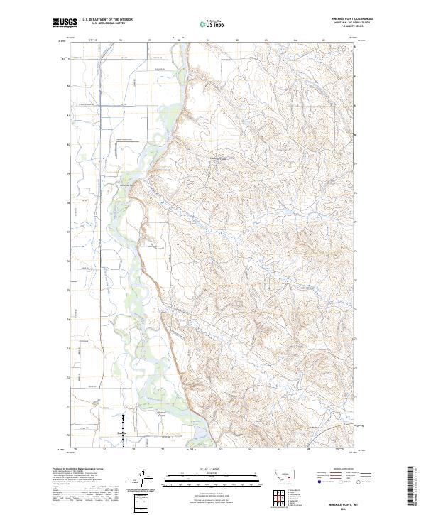
2024 Map of Ninemile Point
USGS Topo · Published 2024About this map
The Bighorn River carves a fertile corridor through Big Horn County, defining the western edge of this landscape where the valley floor meets the higher prairie benches. The city of Hardin anchors the southern boundary, its proximity to the water reflected in the complex network of irrigation and utility infrastructure, including the Big Horn Low Line Canal and the Hardin Generation Station Rd. This 2024 survey captures a rural Montana landscape shaped by both natural drainage and human engineering, with numerous coulees like Chapman Coulee and Whitman Coulee cutting toward the river. To the east, the terrain rises into the distinctive formation of Hive Butte, overlooking the winding course of Ninemile Creek and the marshy grounds of Arapooish Pond. The map detail includes a dense network of local roads such as Grant Marsh Loop and Nine Mile Creek Rd, which provide access to the river's namesake landmark at Ninemile Point.
Find a feature on this map
46 named features on this map. Tap any name to fly to it.
Don’t see what you’re looking for? This feature index may not catch every label — zoom into the map to look around manually.
Map Details
Editions of this 2024 Ninemile Point Map
This is the sole edition of this map. No revisions or reprints were ever made.
Other maps of this area

1894 · Fort Custer
USGS Topo · 1:125,000

1954 · Hardin
USGS Topo · 1:250,000

1957 · Hardin
USGS Topo · 1:250,000

1958 · Hardin
USGS Topo · 1:250,000

1960 · Foster
USGS Topo · 1:24,000

1960 · Ninemile Point
USGS Topo · 1:24,000

1960 · Chimney Creek
USGS Topo · 1:24,000

1960 · Walker Hill
USGS Topo · 1:24,000

1960 · Hardin
USGS Topo · 1:24,000
1960 · Lemon Ranch
USGS Topo · 1:24,000