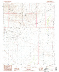
1988 Map of Ninemile Wash
USGS Topo · Published 1988About this map
The Chocolate Mountain Aerial Gunnery Range dominates the high desert landscape of Imperial County in this late 1980s provisional study. The map reveals an area defined by intense mineral exploration and military designation, where countless prospects and prospect pits dot the arid terrain. Commercial mining activity is prominent, anchored by the Mesquite Mine and Rainbow Mine, while historic operations like the Old Channel Mine Shaft suggest a long legacy of extraction in these mountains.
Find a feature on this map
17 named features on this map. Tap any name to fly to it.
Don’t see what you’re looking for? This feature index may not catch every label — zoom into the map to look around manually.
Map Details
Editions of this 1988 Ninemile Wash Map
2 editions found
Other maps of this area

1903 · Yuma
USGS Topo · 1:125,000

1905 · Yuma
USGS Topo · 1:125,000

1907 · Holtville
USGS Topo · 1:125,000

1942 · El Centro
USGS Topo · 1:250,000

1942 · Yuma
USGS Topo · 1:250,000

1942 · Blythe
USGS Topo · 1:250,000

1953 · Quartz Peak
USGS Topo · 1:62,500

1953 · Ogilby
USGS Topo · 1:62,500

1953 · Acolita
USGS Topo · 1:62,500

1954 · El Centro
USGS Topo · 1:250,000