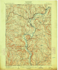
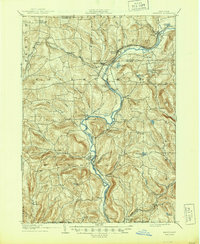
1905 Map of Nineveh
USGS Topo · Published 1913About this map
The Susquehanna River carves a dominant path through this portion of Broome and Chenango counties, dictating the development of early 20th-century transportation and settlement. The Delaware and Hudson railroad tracks the river's winding course, linking significant local hubs like Nineveh Junction and Harpursville. Further south, the Erie R. R. cuts across the landscape near Gulf Summit, illustrating the complex rail network required to navigate the area's steep terrain and creek valleys.
Find a feature on this map
60 named features on this map. Tap any name to fly to it.
Don’t see what you’re looking for? This feature index may not catch every label — zoom into the map to look around manually.
Map Details
Editions of this 1905 Nineveh Map
6 editions found
Other maps of this area

1902 · Coventry
USGS Topo · 1:62,500

1904 · Binghamton
USGS Topo · 1:62,500

1904 · Greene
USGS Topo · 1:62,500

1904 · Oxford
USGS Topo · 1:62,500

1905 · Nineveh
USGS Topo · 1:62,500

1915 · Unadilla
USGS Topo · 1:62,500

1918 · Unadilla
USGS Topo · 1:62,500

1924 · Starrucca
USGS Topo · 1:48,000

1924 · Deposit
USGS Topo · 1:62,500

1926 · Deposit
USGS Topo · 1:62,500