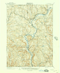
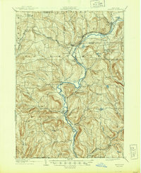
1905 Map of Nineveh
USGS Topo · Published 1944About this map
The Susquehanna River winds through the heart of this Susquehanna Valley region at the turn of the century, serving as the primary corridor for both natural drainage and industrial transport. The early 1900s landscape is defined by the convergence of major rail lines, including the Delaware and Hudson and the Erie RR, which facilitated the growth of shipping points like Nineveh Junction and Harpursville Sta. The map documents a dense network of valley settlements from Afton in the northeast to Windsor in the south, connected by winding roads that follow the creek beds of Onaquaga Creek and Occanum Creek.
Find a feature on this map
68 named features on this map. Tap any name to fly to it.
Don’t see what you’re looking for? This feature index may not catch every label — zoom into the map to look around manually.
Map Details
Editions of this 1905 Nineveh Map
6 editions found
Other maps of this area

1902 · Coventry
USGS Topo · 1:62,500

1904 · Binghamton
USGS Topo · 1:62,500

1904 · Greene
USGS Topo · 1:62,500

1904 · Oxford
USGS Topo · 1:62,500

1905 · Nineveh
USGS Topo · 1:62,500

1915 · Unadilla
USGS Topo · 1:62,500

1918 · Unadilla
USGS Topo · 1:62,500

1924 · Starrucca
USGS Topo · 1:48,000

1924 · Deposit
USGS Topo · 1:62,500

1926 · Deposit
USGS Topo · 1:62,500