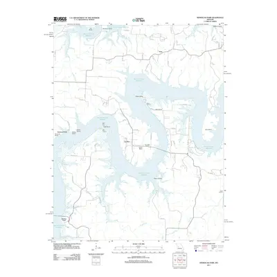
2011 Map of Ninnescah Park
USGS Topo · Published 2011About this map
The Harry S Truman Reservoir dominates this landscape in the Western Ozarks, where the Osage River's flooded valleys create a labyrinth of peninsulas and islands. Small settlements like Finey and Fox Run are situated among a series of dramatic river bends, including Udo Bend, McGuiness Bend, and Harris Bend. This 2011 survey captures the modern topography of a region defined by its water-access points and leisure sites like Ninnescah Park.
Find a feature on this map
71 named features on this map. Tap any name to fly to it.
Don’t see what you’re looking for? This feature index may not catch every label — zoom into the map to look around manually.
Map Details
Editions of this 2011 Ninnescah Park Map
This is the sole edition of this map. No revisions or reprints were ever made.
Other maps of this area

1887 · Clinton
USGS Topo · 1:125,000

1887 · Warsaw
USGS Topo · 1:125,000

1894 · Warsaw
USGS Topo · 1:125,000

1894 · Clinton
USGS Topo · 1:125,000

1936 · Shawnee Bend
USGS Topo · 1:24,000

1939 · Osceola
USGS Topo · 1:24,000

1940 · Osceola
USGS Topo · 1:24,000

1940 · Iconium
USGS Topo · 1:24,000

1941 · Valhalla
USGS Topo · 1:24,000

1941 · Lowry City
USGS Topo · 1:24,000