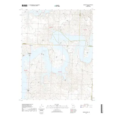
2017 Map of Ninnescah Park
USGS Topo · Published 2017About this map
The Harry S Truman Reservoir dominates this landscape where the borders of Henry, Benton, and St. Clair counties converge. The irregular shoreline of the reservoir creates numerous landforms including Harris Bend, Talley Bend, and Smith Bend, while high points like Buzzards Roost look over Millers Island. The map records several legacy burial sites situated above the waterline, such as Peaceful Home Cem and Gilbert Cem. Settlement is concentrated at Finey and near Browns Ford, connected by a network of secondary roads and state highways like State Hwy Z. Local water sources including White Sulphur Springs and Berry Spring highlight the area's natural hydrography, providing a detailed look at the rural character and topographic complexity of this Missouri river-valley region.
Find a feature on this map
76 named features on this map. Tap any name to fly to it.
Don’t see what you’re looking for? This feature index may not catch every label — zoom into the map to look around manually.
Map Details
Editions of this 2017 Ninnescah Park Map
This is the sole edition of this map. No revisions or reprints were ever made.
Other maps of this area

1887 · Clinton
USGS Topo · 1:125,000

1887 · Warsaw
USGS Topo · 1:125,000

1894 · Warsaw
USGS Topo · 1:125,000

1894 · Clinton
USGS Topo · 1:125,000

1936 · Shawnee Bend
USGS Topo · 1:24,000

1939 · Osceola
USGS Topo · 1:24,000

1940 · Osceola
USGS Topo · 1:24,000

1940 · Iconium
USGS Topo · 1:24,000

1941 · Valhalla
USGS Topo · 1:24,000

1941 · Lowry City
USGS Topo · 1:24,000