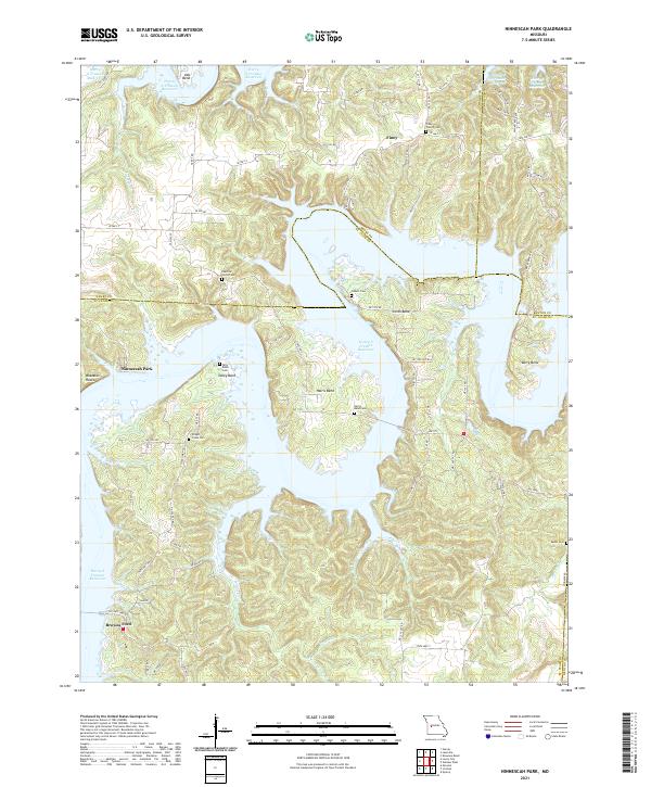
2021 Map of Ninnescah Park
USGS Topo · Published 2021About this map
The expansive Harry S Truman Reservoir dominates this landscape where the boundaries of Henry, Benton, and St. Clair counties meet. The complex shoreline is defined by prominent landforms such as Tally Bend, Harris Bend, and Berry Bend, reflecting the topography created when the Osage River valley was flooded. The map preserves the locations of numerous family and community burial grounds that predate the reservoir, including the Peaceful Home Cem and Akens Cem. Inland from the water, the settlement of Finey and the Finey Church Cem serve as focal points for the rural road network. Significant drainage systems like Wright Cr and Jackson Br flow into the reservoir, while landmarks such as Buzzards Roost and Udo Bend provide a look into the local geography near Ninnescah Park.
Find a feature on this map
71 named features on this map. Tap any name to fly to it.
Don’t see what you’re looking for? This feature index may not catch every label — zoom into the map to look around manually.
Map Details
Editions of this 2021 Ninnescah Park Map
This is the sole edition of this map. No revisions or reprints were ever made.
Other maps of this area

1887 · Clinton
USGS Topo · 1:125,000

1887 · Warsaw
USGS Topo · 1:125,000

1894 · Warsaw
USGS Topo · 1:125,000

1894 · Clinton
USGS Topo · 1:125,000

1936 · Shawnee Bend
USGS Topo · 1:24,000

1939 · Osceola
USGS Topo · 1:24,000

1940 · Osceola
USGS Topo · 1:24,000

1940 · Iconium
USGS Topo · 1:24,000

1941 · Valhalla
USGS Topo · 1:24,000

1941 · Lowry City
USGS Topo · 1:24,000