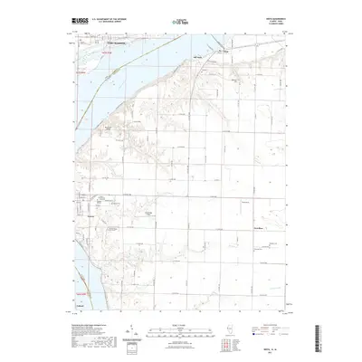
2021 Map of Niota
USGS Topo · Published 2021About this map
The Mississippi River creates a wide natural boundary between Iowa and Illinois on this 2021 survey, anchoring the industrial hub of Fort Madison on its northern bank. The landscape transition from the riverfront to the interior bluffs is marked by the presence of significant local cemeteries, including the Old Nauvoo Burial Grounds and Nauvoo Old Cem, reflecting the deep religious and communal history of Nauvoo. Further inland, the terrain is defined by a network of drainage systems like Tyson Creek and Robinson Creek that carve through the agricultural fields of the Illinois side. Small landing facilities such as Winchester Airport and Cedar Ridge Airport dot the high ground between these creek valleys. The map also captures the distinct settlement patterns of the river towns Niota and Old Niota, and the rural community of Powellton to the south, connected by a structured grid of county roads.
Find a feature on this map
83 named features on this map. Tap any name to fly to it.
Don’t see what you’re looking for? This feature index may not catch every label — zoom into the map to look around manually.
Map Details
Editions of this 2021 Niota Map
This is the sole edition of this map. No revisions or reprints were ever made.
Other maps of this area

1932 · Lomax
USGS Topo · 1:62,500

1933 · Carthage
USGS Topo · 1:62,500

1936 · Keokuk
USGS Topo · 1:62,500

1936 · Fort Madison
USGS Topo · 1:62,500

1937 · Carthage
USGS Topo · 1:62,500

1937 · Lomax
USGS Topo · 1:62,500

1950 · Keokuk
USGS Topo · 1:62,500

1958 · Burlington
USGS Topo · 1:250,000

1961 · Burlington
USGS Topo · 1:250,000

1963 · Burlington
USGS Topo · 1:250,000