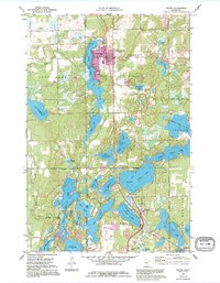
1959 Map of Nisswa
USGS Topo · Published 1995About this map
Pequot Lakes and Nisswa anchor this survey of the Brainerd Lakes area, a landscape defined by an intricate network of glacial basins and interconnected waterways. The map illustrates a period of mid-century growth along the corridors between Sibley Lake and Lake Hubert. Local development is evident in the residential clusters of Lake Shore and the recreational infrastructure surrounding Lower Cullen Lake, including a Golf Course and the nearby Church of the Cross. Significant cultural landmarks, such as the Pequot Lookout Tower and the Nisswa Cem, provide touchpoints for genealogists and local historians. The transition from the rural character of Sibley to the organized corporate boundaries of the resort communities reflects the evolving post-war identity of Crow Wing County. Smaller water bodies like Lake Edna, Pawn Lake, and Cloverleaf Lake fill the spaces between larger lakes, creating a complex hydrographic pattern typical of the Minnesota north woods.
Find a feature on this map
47 named features on this map. Tap any name to fly to it.
Don’t see what you’re looking for? This feature index may not catch every label — zoom into the map to look around manually.
Map Details
Editions of this 1959 Nisswa Map
4 editions found
Other maps of this area

1915 · Brainerd
USGS Topo · 1:62,500

1916 · Pillager
USGS Topo · 1:62,500

1918 · Brainerd
USGS Topo · 1:62,500

1919 · Pillager
USGS Topo · 1:62,500

1953 · Brainerd
USGS Topo · 1:250,000

1957 · Brainerd
USGS Topo · 1:250,000

1958 · Brainerd
USGS Topo · 1:250,000

1959 · Pelican Lake
USGS Topo · 1:24,000

1959 · Nisswa
USGS Topo · 1:24,000

1959 · Lower Whitefish Lake
USGS Topo · 1:24,000