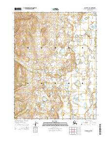
2015 Map of Noatak C-3 SE
USGS Topo · Published 2015About this map
Kuchoruk Cr meanders southward through this arctic landscape, where the vast drainage system of the Noatak River dominates the southeastern corner. This 2015 survey illustrates the immense, undeveloped reaches of the Northwest Arctic Borough, defined by complex hydrography and varying elevation contours rather than human settlements or roads. The map reveals the intricate network of seasonal watercourses and wetlands that characterize this region, offering a clear view of the natural terrain before any modern infrastructure was established. Researchers can trace the boundaries of several townships, including t25n r19w and t26n r20w, which provide a structural framework for this otherwise wild expanse of the Alaskan wilderness.
Find a feature on this map
8 named features on this map. Tap any name to fly to it.
Don’t see what you’re looking for? This feature index may not catch every label — zoom into the map to look around manually.
Map Details
Editions of this 2015 Noatak C-3 SE Map
This is the sole edition of this map. No revisions or reprints were ever made.
Other maps of this area

1951 · Noatak
USGS Topo · 1:250,000

1955 · Noatak
USGS Topo · 1:250,000

1955 · Noatak C-2
USGS Topo · 1:63,360

1955 · Noatak B-3
USGS Topo · 1:63,360

1955 · Noatak C-3
USGS Topo · 1:63,360

1955 · Noatak B-2
USGS Topo · 1:63,360

1964 · Noatak
USGS Topo · 1:250,000
2014 · Noatak C-3 NW
USGS Topo · 1:25,000
2014 · Noatak C-3 NE
USGS Topo · 1:25,000
2015 · Noatak C-2 NW
USGS Topo · 1:25,000