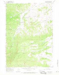
1967 Map of Noble Basin
USGS Topo · Published 1971About this map
Dead Shot Ranch sits near the heart of this Wyoming landscape, where the Teton National Forest meets the Bridger National Forest. The 1960s terrain is defined by the steep descent of the Hoback River through Hoback Canyon and Upper Hoback Canyon. This area of Sublette County showcases a network of primitive access points, including a remote landing strip and numerous jeep trails and pack trails used for livestock and forest management.
Find a feature on this map
28 named features on this map. Tap any name to fly to it.
Don’t see what you’re looking for? This feature index may not catch every label — zoom into the map to look around manually.
Map Details
Editions of this 1967 Noble Basin Map
3 editions found
Other maps of this area

1907 · Gros Ventre
USGS Topo · 1:125,000

1910 · Gros Ventre
USGS Topo · 1:125,000

1921 · Afton
USGS Topo · 1:125,000

1931 · Jackson
USGS Topo · 1:125,000

1935 · Jackson
USGS Topo · 1:125,000

1939 · Big Piney
USGS Topo · 1:125,000

1942 · Big Piney
USGS Topo · 1:125,000

1955 · Driggs
USGS Topo · 1:250,000

1955 · Preston
USGS Topo · 1:250,000

1958 · Driggs
USGS Topo · 1:250,000