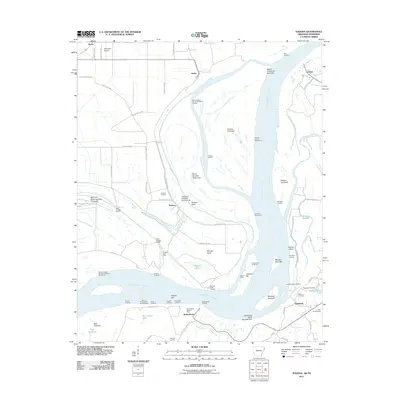
2011 Map of Nodena
USGS Topo · Published 2011About this map
Chickasaw Bluff Number Two rises above the Mississippi River where the borders of Arkansas and Tennessee meet, framing a landscape defined by shifting currents and riverfront industry. The settlement of Randolph sits on the eastern bank, once a significant river port, while across the water in Arkansas, Nodena and Richardsons anchor the flat alluvial plains. The map details an extensive network of river features including Island Number Thirty-four and various revetments and dikes, such as the Morgan Point Dikes, which reflect the constant effort to manage the river's course.
Find a feature on this map
81 named features on this map. Tap any name to fly to it.
Don’t see what you’re looking for? This feature index may not catch every label — zoom into the map to look around manually.
Map Details
Editions of this 2011 Nodena Map
This is the sole edition of this map. No revisions or reprints were ever made.
Other maps of this area

1931 · Jericho
USGS Topo · 1:62,500

1939 · Jericho
USGS Topo · 1:62,500

1939 · Evadale
USGS Topo · 1:62,500

1942 · Millington
USGS Topo · 1:62,500

1952 · Jericho
USGS Topo · 1:62,500

1953 · Memphis
USGS Topo · 1:250,000

1956 · Evadale
USGS Topo · 1:62,500

1956 · Memphis
USGS Topo · 1:250,000

1956 · Blytheville
USGS Topo · 1:250,000

1959 · Blytheville
USGS Topo · 1:250,000