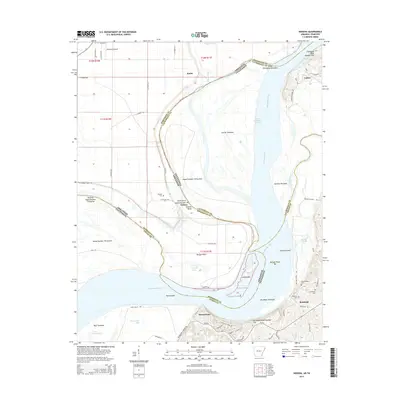
2014 Map of Nodena
USGS Topo · Published 2014About this map
The Mississippi River creates a complex borderland here, where the state line weaves between numerous islands and towheads. To the east, the Hatchie River joins the main channel near Randolph, a settlement situated against the rising elevation of Chickasaw Bluff Number Two. This bluff line provides a sharp contrast to the low-lying alluvial plains of the Arkansas side, where the community of Nodena and the Nodena Cem sit behind Levee Rd. The landscape is defined by the river's historical shifts, evidenced by features like Sunrise Towhead and the Towhead of Island Number 34. Genealogists will find several family and community burial sites clustered near the bluffs, including Old Randolph Cem, Randolph Cem, and Williams Cem. In the northwest, aviation infrastructure appears with Ohlendorf Airport near the border of Butler.
Find a feature on this map
78 named features on this map. Tap any name to fly to it.
Don’t see what you’re looking for? This feature index may not catch every label — zoom into the map to look around manually.
Map Details
Editions of this 2014 Nodena Map
This is the sole edition of this map. No revisions or reprints were ever made.
Other maps of this area

1931 · Jericho
USGS Topo · 1:62,500

1939 · Jericho
USGS Topo · 1:62,500

1939 · Evadale
USGS Topo · 1:62,500

1942 · Millington
USGS Topo · 1:62,500

1952 · Jericho
USGS Topo · 1:62,500

1953 · Memphis
USGS Topo · 1:250,000

1956 · Evadale
USGS Topo · 1:62,500

1956 · Memphis
USGS Topo · 1:250,000

1956 · Blytheville
USGS Topo · 1:250,000

1959 · Blytheville
USGS Topo · 1:250,000