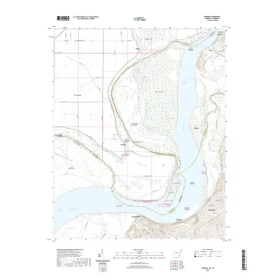
2020 Map of Nodena
USGS Topo · Published 2020About this map
The Mississippi River meanders through this borderland, creating a complex geography of shifting bars, towheads, and chutes between Arkansas and Tennessee. High ground is found along the eastern bank at Chickasaw Bluff Number One and Chickasaw Bluff Number Two, where the settlements of Fulton and Randolph are established safely above the floodplain. This area is steeped in local history, featuring several burial sites such as the Old Randolph Cem, Randolph Cem, and Williams Cem.
Find a feature on this map
72 named features on this map. Tap any name to fly to it.
Don’t see what you’re looking for? This feature index may not catch every label — zoom into the map to look around manually.
Map Details
Editions of this 2020 Nodena Map
This is the sole edition of this map. No revisions or reprints were ever made.
Other maps of this area

1931 · Jericho
USGS Topo · 1:62,500

1939 · Jericho
USGS Topo · 1:62,500

1939 · Evadale
USGS Topo · 1:62,500

1942 · Millington
USGS Topo · 1:62,500

1952 · Jericho
USGS Topo · 1:62,500

1953 · Memphis
USGS Topo · 1:250,000

1956 · Evadale
USGS Topo · 1:62,500

1956 · Memphis
USGS Topo · 1:250,000

1956 · Blytheville
USGS Topo · 1:250,000

1959 · Blytheville
USGS Topo · 1:250,000