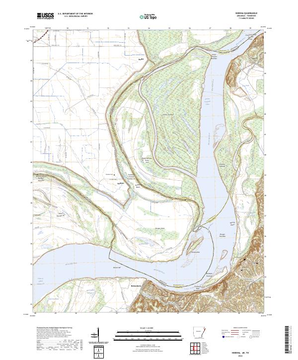
2024 Map of Nodena
USGS Topo · Published 2024About this map
The Mississippi River creates a complex borderland where Arkansas and Tennessee meet, characterized by shifting bars and towheads that have historically redrawn the state lines. The eastern bank is defined by the prominent elevations of Chickasaw Bluff Number One near Fulton and Chickasaw Bluff Number Two further south, providing a natural high-ground contrast to the alluvial lowlands. These bluffs offer a permanent topographical anchor in a landscape otherwise dominated by the river's fluid dynamics, including Sunrise Towhead and the Chute of Island Number 35.
Find a feature on this map
70 named features on this map. Tap any name to fly to it.
Don’t see what you’re looking for? This feature index may not catch every label — zoom into the map to look around manually.
Map Details
Editions of this 2024 Nodena Map
This is the sole edition of this map. No revisions or reprints were ever made.
Other maps of this area

1931 · Jericho
USGS Topo · 1:62,500

1939 · Jericho
USGS Topo · 1:62,500

1939 · Evadale
USGS Topo · 1:62,500

1942 · Millington
USGS Topo · 1:62,500

1952 · Jericho
USGS Topo · 1:62,500

1953 · Memphis
USGS Topo · 1:250,000

1956 · Evadale
USGS Topo · 1:62,500

1956 · Memphis
USGS Topo · 1:250,000

1956 · Blytheville
USGS Topo · 1:250,000

1959 · Blytheville
USGS Topo · 1:250,000