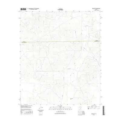
2016 Map of Noelke SE
USGS Topo · Published 2016About this map
Dove Creek Draw defines the southern reach of this landscape, where the ephemeral flow of Dove Cr moves through a topography of mesas and drainages. The map reveals the boundary between Irion and Schleicher counties, cutting across a region primarily organized by ranch roads and long-distance travel routes. Local infrastructure is marked by a network of rural corridors including FM 915, Boyce Rd, and the distinctively named Bootleggers Ln. Further north, Hodnett Rd and Co Rd 115 intersect the upper draws. This 2016 survey captures the contemporary state of these Texas ranchlands, where named routes like Meltzon and P 4275 provide access to the interior of these extensive land holdings, reflecting the enduring rural character of the Edwards Plateau region.
Find a feature on this map
13 named features on this map. Tap any name to fly to it.
Don’t see what you’re looking for? This feature index may not catch every label — zoom into the map to look around manually.
Map Details
Editions of this 2016 Noelke SE Map
This is the sole edition of this map. No revisions or reprints were ever made.
Other maps of this area
1895 · Sherwood
USGS Topo · 1:125,000

1954 · Sonora
USGS Topo · 1:250,000

1954 · San Angelo
USGS Topo · 1:250,000

1958 · Sonora
USGS Topo · 1:250,000
1958 · San Angelo
USGS Topo · 1:250,000
1964 · Eldorado NW
USGS Topo · 1:24,000
1964 · Oglesby Ranch
USGS Topo · 1:24,000
1964 · Moore Ranch
USGS Topo · 1:24,000
1965 · San Angelo
USGS Topo · 1:250,000
1971 · Noelke
USGS Topo · 1:24,000