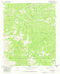
1982 Map of Nogal Peak
USGS Topo · Published 1982About this map
Nogal Peak and the high mountain ridges of the Lincoln National Forest dominate this landscape during the early 1980s. The map illustrates a region defined by its transition from industrial extraction to alpine recreation. To the north, the legacy of New Mexico mining is visible through a cluster of sites including Parsons Mine, the Silver Spoon Mine, and the Great Western Mine. To the south, the economy shifts toward the slopes of the Sierra Blanca Ski Area, with its network of ski lifts near Apache Bowl and Lookout Mountain.
Find a feature on this map
79 named features on this map. Tap any name to fly to it.
Don’t see what you’re looking for? This feature index may not catch every label — zoom into the map to look around manually.
Map Details
Editions of this 1982 Nogal Peak Map
2 editions found
Other maps of this area

1934 · Capitan
USGS Topo · 1:48,000

1937 · Capitan
USGS Topo · 1:62,500

1938 · Carrizozo
USGS Topo · 1:48,000

1943 · Carrizozo
USGS Topo · 1:62,500

1950 · Carrizozo
USGS Topo · 1:62,500

1950 · Sierra Blanca Peak
USGS Topo · 1:62,500

1955 · Roswell
USGS Topo · 1:250,000

1958 · Roswell
USGS Topo · 1:250,000

1962 · Roswell
USGS Topo · 1:250,000

1963 · Ruidoso
USGS Topo · 1:24,000