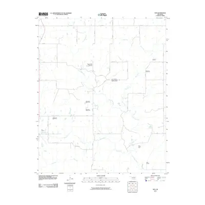
2010 Map of Non
USGS Topo · Published 2010About this map
Non Cemetery and Rock Creek Cemetery serve as historical anchors for this rural landscape in Hughes County, Oklahoma. The area is defined by a dense network of watercourses, including the winding Caney Boggy Creek, Sandy Creek, and Pine Creek, which shape the local topography and land use. The map reveals an extensive system of water management and flood control structures, featuring specifically named landmarks like the Upper Muddy Boggy Site Number 24 Dam, the Upper Muddy Boggy Site Number 25 Dam, and the Elmo Tipton Dam. These features, along with several Oknoname-designated dams, illustrate the region's 21st-century efforts to regulate the tributaries of the Muddy Boggy River system. A grid of local roads, such as Eden Rd and E 1500 Rd, provides access to the small farmsteads and natural features like King Hollow situated in the southern portion of the quadrangle.
Find a feature on this map
37 named features on this map. Tap any name to fly to it.
Don’t see what you’re looking for? This feature index may not catch every label — zoom into the map to look around manually.
Map Details
Editions of this 2010 Non Map
This is the sole edition of this map. No revisions or reprints were ever made.
Other maps of this area

1896 · Coalgate
USGS Topo · 1:125,000

1899 · Coalgate
USGS Topo · 1:125,000

1900 · Coalgate
USGS Topo · 1:125,000

1957 · Tupelo NE
USGS Topo · 1:24,000

1957 · Ardmore
USGS Topo · 1:250,000

1963 · Ardmore
USGS Topo · 1:250,000
1967 · Wardville
USGS Topo · 1:24,000

1967 · Calvin East
USGS Topo · 1:24,000
1967 · Ashland
USGS Topo · 1:24,000
1967 · Non
USGS Topo · 1:24,000