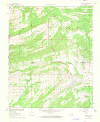
1967 Map of Wardville
USGS Topo · Published 1968About this map
Wardville sits at the convergence of several county lines in this late 1960s survey, marking a transition point between the Jackson Prairie and the ridgelines of Stringtown. This landscape is defined by its complex drainage network, where North Boggy Creek and Rabbit Creek flow through the southeastern corner of the quadrangle. The map reveals a rural economy supported by scattered energy and mineral extraction, indicated by numerous Gas Wells and a Gravel Pit.
Find a feature on this map
30 named features on this map. Tap any name to fly to it.
Don’t see what you’re looking for? This feature index may not catch every label — zoom into the map to look around manually.
Map Details
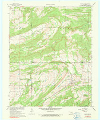
Editions of this 1967 Wardville Map
2 editions found
Other maps of this area

1896 · Coalgate
USGS Topo · 1:125,000

1898 · McAlester
USGS Topo · 1:125,000

1899 · Coalgate
USGS Topo · 1:125,000

1900 · Coalgate
USGS Topo · 1:125,000

1909 · Mc Alester
USGS Topo · 1:125,000

1950 · Mcalester
USGS Topo · 1:250,000

1957 · Coalgate
USGS Topo · 1:24,000

1957 · Coalgate SE
USGS Topo · 1:24,000

1957 · Limestone Gap
USGS Topo · 1:24,000

1957 · Ardmore
USGS Topo · 1:250,000