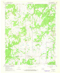
1967 Map of Ashland
USGS Topo · Published 1968About this map
Ashland sits at the center of this rural Oklahoma landscape during the late 1960s, serving as a focal point for a region defined by scattered homesteads and natural drainage. The eastern portion of the map is dominated by the sprawling U S Naval Ammunition Depot, its perimeter defined by a clear Reservation Boundary and a network of numbered military corridors including Road Five and Road Six. This military presence contrasts with the agrarian character of the surrounding townships like Bucklucksy and Kiowa.
Find a feature on this map
32 named features on this map. Tap any name to fly to it.
Don’t see what you’re looking for? This feature index may not catch every label — zoom into the map to look around manually.
Map Details
Editions of this 1967 Ashland Map
2 editions found
Other maps of this area

1896 · Coalgate
USGS Topo · 1:125,000

1898 · McAlester
USGS Topo · 1:125,000

1899 · Coalgate
USGS Topo · 1:125,000

1900 · Coalgate
USGS Topo · 1:125,000

1909 · Mc Alester
USGS Topo · 1:125,000

1950 · Mcalester
USGS Topo · 1:250,000

1957 · Ardmore
USGS Topo · 1:250,000

1962 · McAlester
USGS Topo · 1:250,000

1963 · Ardmore
USGS Topo · 1:250,000

1965 · McAlester
USGS Topo · 1:250,000