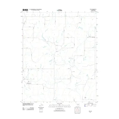
2013 Map of Non
USGS Topo · Published 2013About this map
The settlement of Non and the surrounding Hughes County landscape are defined by a complex network of small tributaries. This rural area is drained by Caney Boggy Cr, Sandy Cr, and Salt Cr, which create a varied terrain of low-lying creek beds and occasional landforms such as King Hollow. The map reveals a highly structured grid of section-line roads, including E 1540 RD and N 3800 RD, which provide access to family burial sites like Non Cem and Rock Creek Cem. Aviation interest is represented by the Christopher M. Rippee Memorial Airport, situated just west of the main cluster of roads in Non. The proximity of Rock Creek and its associated cemetery suggests a legacy of early community centers established along these reliable water sources.
Find a feature on this map
36 named features on this map. Tap any name to fly to it.
Don’t see what you’re looking for? This feature index may not catch every label — zoom into the map to look around manually.
Map Details
Editions of this 2013 Non Map
This is the sole edition of this map. No revisions or reprints were ever made.
Other maps of this area

1896 · Coalgate
USGS Topo · 1:125,000

1899 · Coalgate
USGS Topo · 1:125,000

1900 · Coalgate
USGS Topo · 1:125,000

1957 · Tupelo NE
USGS Topo · 1:24,000

1957 · Ardmore
USGS Topo · 1:250,000

1963 · Ardmore
USGS Topo · 1:250,000
1967 · Wardville
USGS Topo · 1:24,000

1967 · Calvin East
USGS Topo · 1:24,000
1967 · Ashland
USGS Topo · 1:24,000
1967 · Non
USGS Topo · 1:24,000