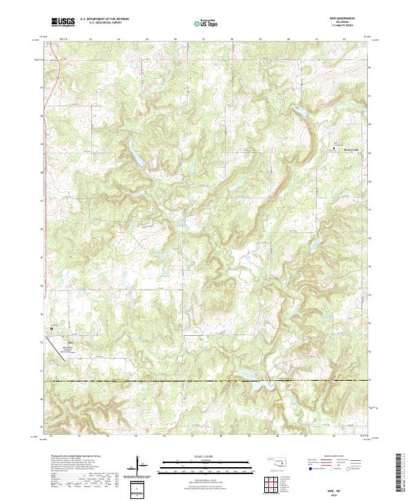
2022 Map of Non
USGS Topo · Published 2022About this map
Non and Rock Creek anchor this rural landscape in southeastern Oklahoma, where the terrain is defined by a dense network of tributaries flowing toward the Canadian River basin. The map illustrates a transitional environment at the Hughes Co Coal Co border, characterized by narrow valleys like King Hollow and winding watercourses such as Caney Boggy Creek and Sandy Creek. Small community landmarks provide vital genealogical touchpoints, including the Non Cem and Rock Creek Cem, which mark the centers of these long-established settlements. The presence of the Christopher M Rippee Memorial Airport south of Non suggests a modern layer of infrastructure atop a traditional agricultural and ranching grid. While the area is largely defined by its drainage basins, including Sweetwater Cr and Piney Creek, the section lines and rural roads like Eden Rd reveal a persistent pattern of land division that has shaped local history for generations.
Find a feature on this map
45 named features on this map. Tap any name to fly to it.
Don’t see what you’re looking for? This feature index may not catch every label — zoom into the map to look around manually.
Map Details
Editions of this 2022 Non Map
This is the sole edition of this map. No revisions or reprints were ever made.
Other maps of this area

1896 · Coalgate
USGS Topo · 1:125,000

1899 · Coalgate
USGS Topo · 1:125,000

1900 · Coalgate
USGS Topo · 1:125,000

1957 · Tupelo NE
USGS Topo · 1:24,000

1957 · Ardmore
USGS Topo · 1:250,000

1963 · Ardmore
USGS Topo · 1:250,000
1967 · Wardville
USGS Topo · 1:24,000

1967 · Calvin East
USGS Topo · 1:24,000
1967 · Ashland
USGS Topo · 1:24,000
1967 · Non
USGS Topo · 1:24,000