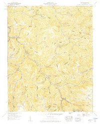
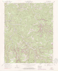
1958 Map of Nora
USGS Topo · Published 1960About this map
The McClure River carves a deep path through Dickenson County, defining the settlement and industrial patterns of this Appalachian landscape in the late 1950s. The Clinchfield RR follows the river's winding course, serving coal-mining operations evidenced by several Strip mines and a prominent Mine dump near Trammel. Communities such as Nora and McClure are linked by the rail line and State Route 80, with significant engineering visible at the Buffalo Tunnel and Martin Tunnel.
Find a feature on this map
111 named features on this map. Tap any name to fly to it.
Don’t see what you’re looking for? This feature index may not catch every label — zoom into the map to look around manually.
Map Details
Editions of this 1958 Nora Map
5 editions found
Other maps of this area

1886 · Grundy
USGS Topo · 1:125,000

1890 · Grundy
USGS Topo · 1:125,000

1892 · Grundy
USGS Topo · 1:125,000

1897 · Bristol
USGS Topo · 1:125,000

1902 · Bristol
USGS Topo · 1:125,000

1913 · Clintwood
USGS Topo · 1:62,500

1914 · Bucu
USGS Topo · 1:48,000

1915 · Clintwood
USGS Topo · 1:62,500

1916 · Bucu
USGS Topo · 1:62,500

1918 · Carterton
USGS Topo · 1:62,500