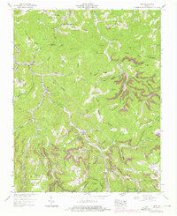
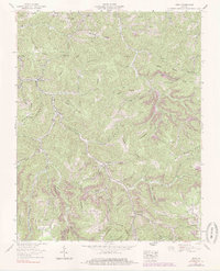
1958 Map of Nora
USGS Topo · Published 1976About this map
The McClure River carves a deep path through the Cumberland Plateau in this mid-century survey of Dickenson County. The rugged topography is defined by a succession of high ridges, including Skeens Ridge, Ball Ridge, and the Sandy Ridge (Tennessee Valley Divide), which dictates the flow of local branches and forks. Human activity is concentrated along these watercourses and the Clinchfield RR, which utilizes engineering feats like the Buffalo Tunnel and Martin Tunnel to navigate the mountain terrain.
Find a feature on this map
97 named features on this map. Tap any name to fly to it.
Don’t see what you’re looking for? This feature index may not catch every label — zoom into the map to look around manually.
Map Details
Editions of this 1958 Nora Map
5 editions found
Other maps of this area

1886 · Grundy
USGS Topo · 1:125,000

1890 · Grundy
USGS Topo · 1:125,000

1892 · Grundy
USGS Topo · 1:125,000

1897 · Bristol
USGS Topo · 1:125,000

1902 · Bristol
USGS Topo · 1:125,000

1913 · Clintwood
USGS Topo · 1:62,500

1914 · Bucu
USGS Topo · 1:48,000

1915 · Clintwood
USGS Topo · 1:62,500

1916 · Bucu
USGS Topo · 1:62,500

1918 · Carterton
USGS Topo · 1:62,500