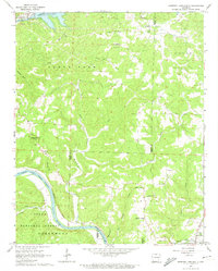
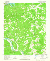
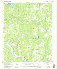
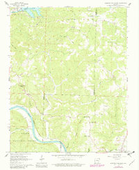
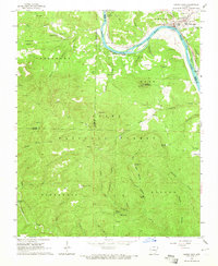
1964 Map of Norfork Dam South
USGS Topo · Published 1974About this map
White River navigation and the Missouri Pacific railroad dominate the southern reaches of this Ozark landscape, where the river winds through the Ozark National Forest. The 1964 terrain reveals a transition from the controlled waters of Norfork Lake near Buckhorn to the deeply dissected hollows of the North Fork and Moccasin Creek drainages. Local life is anchored by dispersed settlements and rural focal points such as Old Joe, Iuka, and Jordan.
Find a feature on this map
47 named features on this map. Tap any name to fly to it.
Don’t see what you’re looking for? This feature index may not catch every label — zoom into the map to look around manually.
Map Details
Editions of this 1964 Norfork Dam South Map
4 editions found
Other maps of this area

1890 · Mountain Home
USGS Topo · 1:125,000

1891 · Mountain Home
USGS Topo · 1:125,000

1894 · Mountain Home
USGS Topo · 1:125,000

1945 · Harrison
USGS Topo · 1:250,000

1949 · Harrison
USGS Topo · 1:250,000

1954 · Harrison
USGS Topo · 1:250,000

1958 · Harrison
USGS Topo · 1:250,000

1964 · Harrison
USGS Topo · 1:250,000
1964 · Calico Rock
USGS Topo · 1:24,000
1964 · Pineville
USGS Topo · 1:24,000