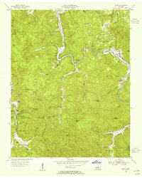
1954 Map of Norma
USGS Topo · Published 1955About this map
The New Tennessee River and New River carve deep paths through this mountainous stretch of the Cumberland Plateau, where industrial and community life centers on the narrow valleys and riverbanks. The mid-1950s landscape is defined by the extraction of natural resources and the presence of small, scattered settlements like Norma and Smoky Creek. A dedicated rail infrastructure, including Brimstone Siding and Goodman Siding, serves the local mining operations, notably the Strip Mine and the mine at Lone Mtn.
Find a feature on this map
77 named features on this map. Tap any name to fly to it.
Don’t see what you’re looking for? This feature index may not catch every label — zoom into the map to look around manually.
Map Details
Editions of this 1954 Norma Map
4 editions found
Other maps of this area

1893 · Briceville
USGS Topo · 1:125,000

1895 · Wartburg
USGS Topo · 1:125,000

1895 · Briceville
USGS Topo · 1:125,000

1896 · Wartburg
USGS Topo · 1:125,000

1896 · Briceville
USGS Topo · 1:125,000

1935 · Gobey
USGS Topo · 1:24,000

1936 · Hogbell Gap
USGS Topo · 1:24,000

1936 · Block
USGS Topo · 1:24,000

1936 · Pioneer
USGS Topo · 1:24,000

1936 · Duncan Flats
USGS Topo · 1:24,000