
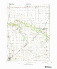
1926 Map of Normal
USGS Topo · Published 1966About this map
Agricultural development and rural educational networks define this central Illinois landscape in the mid-1920s. The burgeoning community of Normal sits at the southwestern corner, serving as a hub for the Illinois Central and Chicago and Alton railroads. To the northeast, Lexington and Towanda are positioned along these same vital rail corridors, which facilitated the movement of grain from the surrounding black-soil prairies. The map reveals an exceptionally dense grid of country schoolhouses, such as Frog Alley Sch and Prairie College Sch, illustrating the dispersed nature of rural life before the consolidation of school districts.
Find a feature on this map
74 named features on this map. Tap any name to fly to it.
Don’t see what you’re looking for? This feature index may not catch every label — zoom into the map to look around manually.
Map Details
Editions of this 1926 Normal Map
2 editions found
Other maps of this area

1927 · Danvers
USGS Topo · 1:62,500

1930 · Danvers
USGS Topo · 1:62,500

1930 · Normal
USGS Topo · 1:62,500

1935 · Pontiac
USGS Topo · 1:62,500

1939 · Pontiac
USGS Topo · 1:62,500

1949 · Mc Lean
USGS Topo · 1:62,500

1951 · McLean
USGS Topo · 1:62,500

1951 · Le Roy
USGS Topo · 1:62,500

1952 · Arrowsmith
USGS Topo · 1:62,500

1955 · Minonk
USGS Topo · 1:62,500