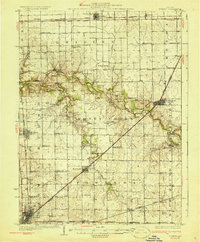
1930 Map of Normal
USGS Topo · Published 1930About this map
The agricultural plains of McLean County are defined here by a dense grid of rural schoolhouses and rail-oriented settlements during the mid-1920s. Established towns like Normal, Lexington, and Towanda anchor the landscape, connected by the diagonal route of the Chicago and Alton railroad. This network reflects the era's decentralized education system, where dozens of locally-named institutions such as Little Red Sch, Frog Alley Sch, and Prairie College Sch served farming families within walking distance of their homesteads.
Find a feature on this map
62 named features on this map. Tap any name to fly to it.
Don’t see what you’re looking for? This feature index may not catch every label — zoom into the map to look around manually.
Map Details
Editions of this 1930 Normal Map
2 editions found
Other maps of this area

1926 · Normal
USGS Topo · 1:62,500

1927 · Danvers
USGS Topo · 1:62,500

1930 · Danvers
USGS Topo · 1:62,500

1930 · Normal
USGS Topo · 1:62,500

1935 · Pontiac
USGS Topo · 1:62,500

1939 · Pontiac
USGS Topo · 1:62,500

1949 · Mc Lean
USGS Topo · 1:62,500

1951 · McLean
USGS Topo · 1:62,500

1951 · Le Roy
USGS Topo · 1:62,500

1952 · Arrowsmith
USGS Topo · 1:62,500