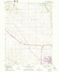
1970 Map of Normal West
USGS Topo · Published 1979About this map
The northern reaches of Normal and the surrounding McLean County countryside are defined by a mix of agricultural heritage and post-war institutional expansion. The State University Farm and a local Golf Course sit at the town's edge, where residential growth indicated by a Trailer Park and the purple-tinted urban extensions of the late 1970s meet the established rural landscape. This transition is marked by numerous family-named burial grounds, including Ropp Cem, Troyer Cem, and Kaufman Cem, which anchor the histories of the surrounding White Oak and Hudson townships.
Find a feature on this map
35 named features on this map. Tap any name to fly to it.
Don’t see what you’re looking for? This feature index may not catch every label — zoom into the map to look around manually.
Map Details
Editions of this 1970 Normal West Map
2 editions found
Other maps of this area

1926 · Normal
USGS Topo · 1:62,500

1927 · Danvers
USGS Topo · 1:62,500

1930 · Danvers
USGS Topo · 1:62,500

1930 · Normal
USGS Topo · 1:62,500

1949 · Mc Lean
USGS Topo · 1:62,500

1951 · McLean
USGS Topo · 1:62,500

1951 · Le Roy
USGS Topo · 1:62,500

1958 · Peoria
USGS Topo · 1:250,000

1961 · Peoria
USGS Topo · 1:250,000

1963 · Peoria
USGS Topo · 1:250,000