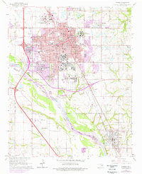
1965 Map of Norman
USGS Topo · Published 1976About this map
University of Oklahoma and its surrounding community define this mid-1960s portrait of Norman, showing the campus landscape including Owen Stadium and the Univ of Okla South Campus. The reach of the Atchison Topeka and Santa Fe railroad corridor cuts through the heart of the city, connecting the urban center to industrial sites like the Norman Townsite Oil Field and the neighboring community of Noble to the southeast. To the north, the Central State Hospital complex and Westheimer Field anchor the periphery of the expanding town.
Find a feature on this map
54 named features on this map. Tap any name to fly to it.
Don’t see what you’re looking for? This feature index may not catch every label — zoom into the map to look around manually.
Map Details
Editions of this 1965 Norman Map
3 editions found
Other maps of this area

1892 · Moore
USGS Topo · 1:62,500

1893 · Norman
USGS Topo · 1:62,500

1893 · Oklahoma City
USGS Topo · 1:62,500

1898 · Purcell
USGS Topo · 1:125,000

1904 · Chickasha
USGS Topo · 1:125,000

1925 · Norman NO 2
USGS Topo · 1:24,000

1934 · Moore
USGS Topo · 1:62,500

1936 · Norman
USGS Topo · 1:62,500

1938 · Moore
USGS Topo · 1:62,500

1954 · Oklahoma City
USGS Topo · 1:250,000