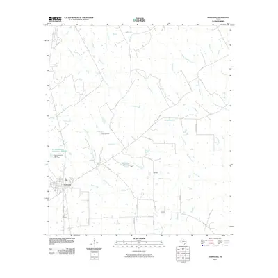
2010 Map of Normangee
USGS Topo · Published 2010About this map
Normangee sits at the junction of FM 39 and the OSR Hwy, serving as a focal point for this rural landscape where family legacies are marked by scattered burial grounds. The quadrangle is notable for its numerous cemeteries, including Rodgers Prairie Cemetery, Randolph Cemetery, and Tenmile Cemetery, which provide critical points of interest for genealogical research in this part of Texas. Water management is a defining characteristic of the terrain, visible through the Cook Lake Dam and the Moss Lake Dam, alongside the Soil Conservation Service Site 1 Dam. The land is deeply etched by a network of drainage systems, with Caney Creek and its many branches, including East Caney Creek, winding through the region alongside Riley Creek and Brushy Creek. This survey captures the transition of the area into a modern agricultural and residential grid, connected by local routes like Batson Rd and Springfield Rd.
Find a feature on this map
50 named features on this map. Tap any name to fly to it.
Don’t see what you’re looking for? This feature index may not catch every label — zoom into the map to look around manually.
Map Details
Editions of this 2010 Normangee Map
This is the sole edition of this map. No revisions or reprints were ever made.
Other maps of this area

1925 · Iola No 2
USGS Topo · 1:48,000

1931 · Iola
USGS Topo · 1:62,500

1953 · Palestine
USGS Topo · 1:250,000

1954 · Waco
USGS Topo · 1:250,000

1954 · Beaumont
USGS Topo · 1:250,000

1954 · Austin
USGS Topo · 1:250,000

1955 · Waco
USGS Topo · 1:250,000

1957 · Beaumont
USGS Topo · 1:250,000

1957 · Palestine
USGS Topo · 1:250,000

1963 · Madisonville
USGS Topo · 1:24,000